Transforming Spatial Data intoActionable Insights
We deliver comprehensive Geographic Information System (GIS) solutions tailored to your specific needs. Our expert team combines cutting-edge technology with industry expertise to help you visualize, analyze, and leverage spatial data for better decision-making.
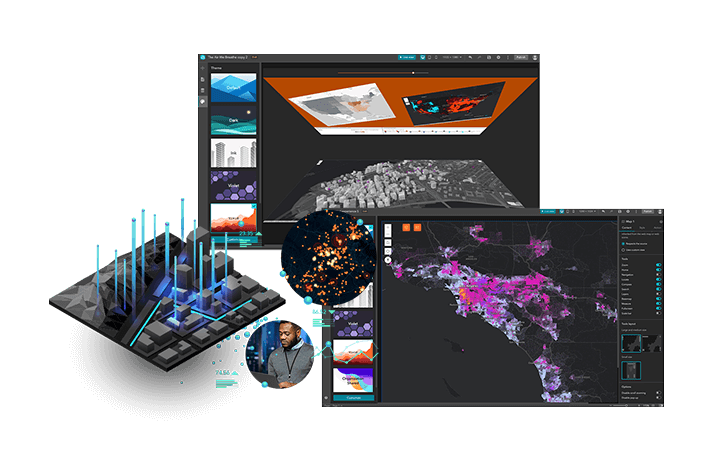
Comprehensive GISSolutions & Expertise
From strategic consulting to custom development, we deliver end-to-end GIS solutions that transform how organizations leverage geospatial technology
Enterprise GIS Consulting & Solution Implementation
Strategic GIS planning, enterprise architecture design, and end-to-end implementation of scalable geospatial solutions for large organizations.
Learn MoreGIS Application Development & Management
Custom GIS application development, web mapping solutions, and ongoing application management tailored to your specific business requirements.
Learn MoreGIS Data Automation & Processing
Automated data workflows, batch processing, spatial analysis automation, and real-time data integration for efficient GIS operations.
Learn MoreDatabase Design & Modeling
Geodatabase design, spatial data modeling, database optimization, and enterprise data architecture for robust GIS foundations.
Learn MoreAdvanced GISCapabilities
Discover our comprehensive range of GIS capabilities designed to transform your spatial data into actionable insights for strategic decision-making
Mapping and Visualization
Turn complex data into clear, interactive maps. We help you create visual tools that reveal patterns and support smarter planning decisions. Perfect for reports, dashboards, and public-facing maps.
Create custom web maps and dashboards
Visualize trends, assets, and spatial relationships
Improve communication with visual clarity

Spatial Analysis
Go beyond basic maps with advanced spatial insights. From proximity analysis to flood simulations, we help uncover trends, risks, and opportunities hidden in your data.
Identify patterns, risks and trends
Perform flood simulation and impact analysis
Support land use, planning, and decision-making
3D GIS
Bring depth and realism to your spatial data. 3D GIS lets you model terrain, buildings, and infrastructure for better visualization and scenario planning.
Model buildings, terrain, and infrastructure
Simulate real-world conditions and viewsheds
Ideal for urban planning and disaster readiness

Field Operations
Streamline data collection and updates directly from the field. Our mobile-first tools empower your team to work online or offline, syncing data in real time.
Collect geospatial data on-site with mobile apps
Track team movements and task status
Seamless integration with your GIS platform

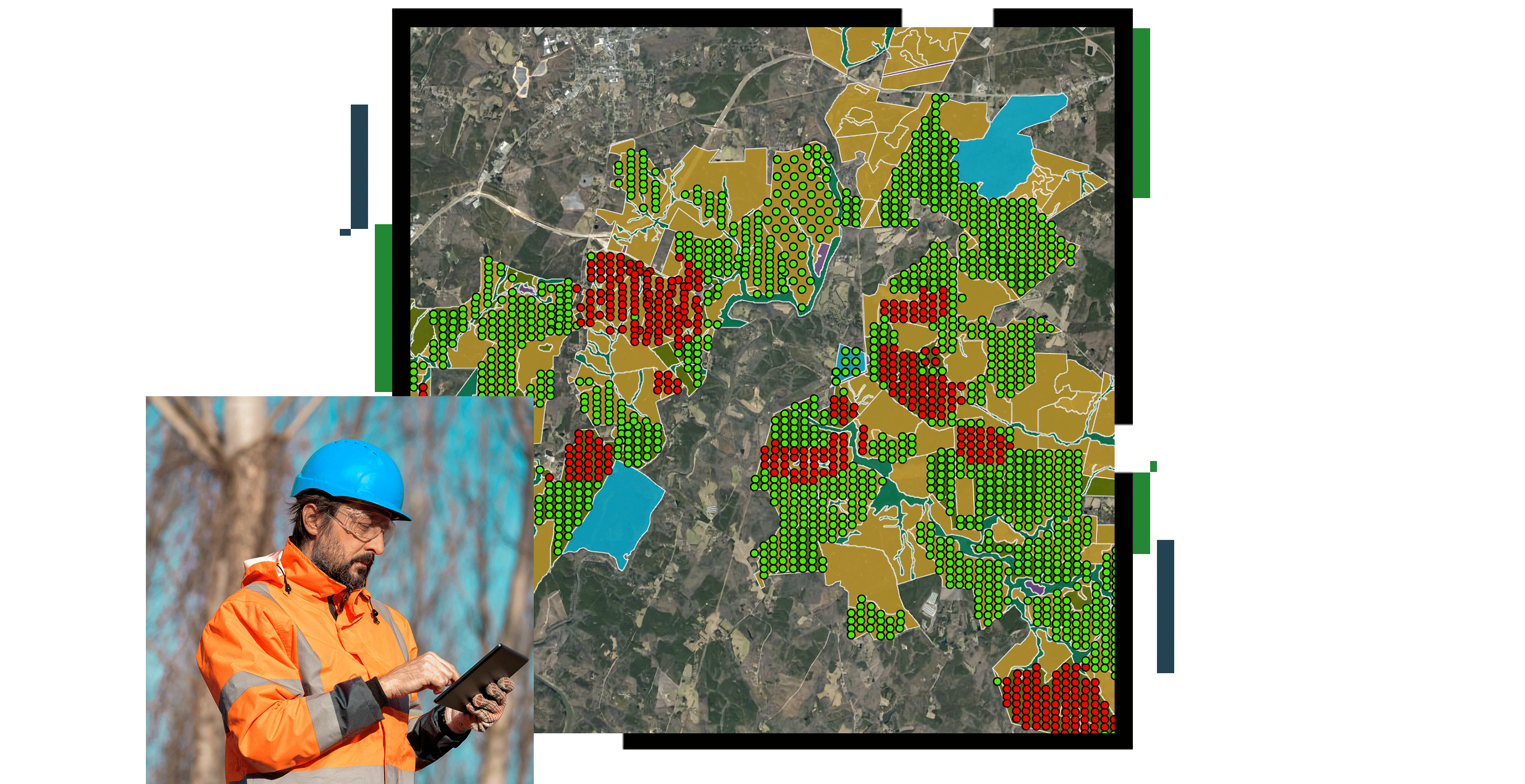
Imagery & Remote Sensing
We process and analyze satellite imagery, aerial photography, and LiDAR data for government and enterprise clients. Our remote sensing solutions support forest monitoring, agricultural assessments, and environmental analysis using advanced datasets and processing techniques.
Satellite imagery analysis and interpretation
LiDAR data processing and elevation modeling
Change detection and temporal analysis
Environmental monitoring and compliance reporting
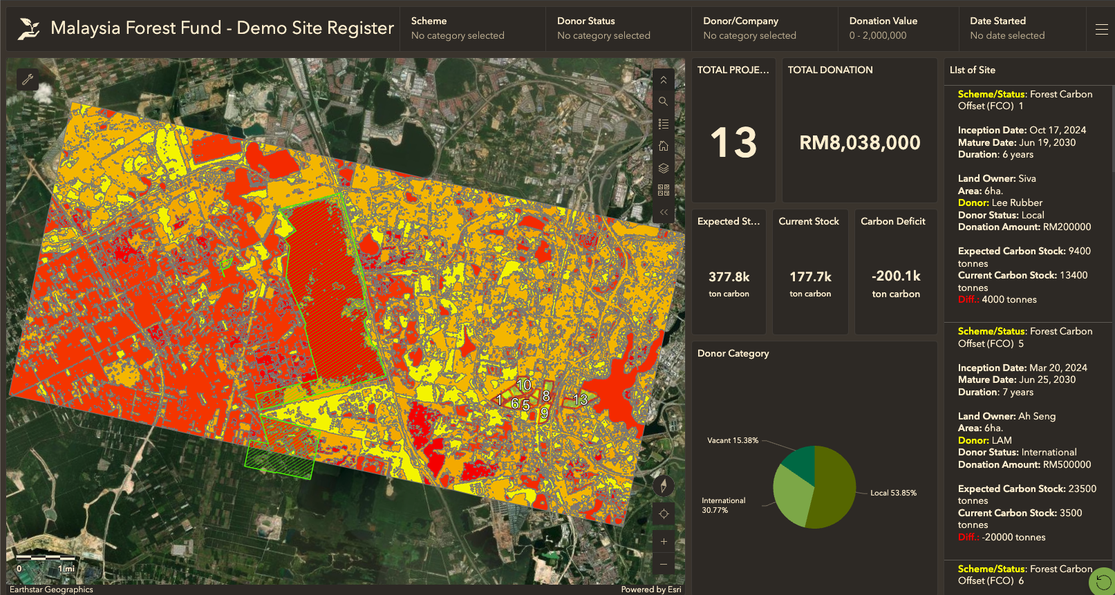
Data Collection and Management
We design and implement comprehensive spatial data workflows from field collection to enterprise storage. Our solutions ensure data accuracy, accessibility, and security while supporting efficient decision-making processes for government and enterprise operations.
Field data collection using mobile GIS applications
Custom geodatabase design and implementation
API integration and automated data pipelines
Data validation and quality assurance processes